- All Locations :


Large box of chart books, waterway guides, waterproof charts, magazines, electronic navigation CDs and more available (see below for titles)
Willing to sell individually or all together – make us an offer.
Pick up from Shelter Island Marina and Boat Yard in Richmond.
Physical charts and books available:
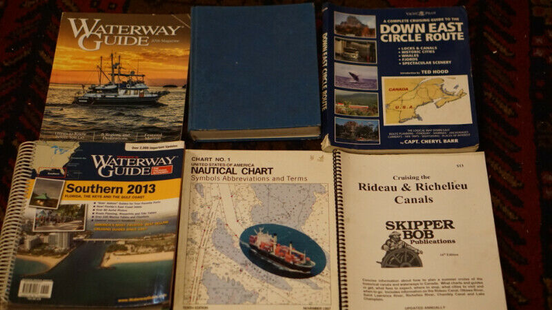
-Waterway Guide Magazine (2016)
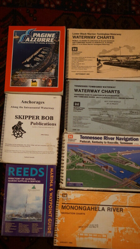
Anchorages Along the Intracoastal Waterway 20th Edition (2015)
-Pagine Azzurre – Il Portolano Dei Mari D’Italia (2012)
-USA Nautical Chart: Symbols, Abbreviations and Terms 10th Edition (1997)
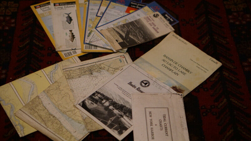
-Bassin De Chambly To Lake Champlain Small Craft Chart 1984/1995 (reprint)
-Tennessee to Tombigbee Waterway Charts (1991)
-Lower Black Warrior to Tombigbee Waterway Charts (1989)
-Long Island Sound Waterproof Chart #1.3
-Champlain Canal and Southern Lake Champlain Waterproof Chart #11 (1994)
-Hudson River Waterproof Chart #3.2
-Northern Lake Champlain Burlington to Richelieu River Waterproof Chart #12 (1997)
-Sandy Hook to Little Egg Harbor Nautical Chart 28th Edition (1997)
-Long Island’s South Shore Waterproof Chart #3.2
-Connecticut River Hartford to Old Saybrook Waterproof Chart #54.2 (2011)
-New Orleans & Lake Pontchartrain Waterproof Chart #58 (2000)
-Mobile Entrance to Lake Borgne Waterproof Chart #57 (2009)
-Mobile Bay to Pensacola Waterproof Chart #55.2 (2011)
-REEDS Marina & Waypoint Guide for UK, Ireland & Channel Islands (2006)
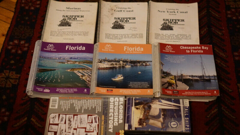
-Florida Cruising Directory 34th Edition (2016/2017)
-Skipper Bob’s Marinas Along the Intracoastal Waterway 17th Edition (2013)
-Skipper Bob’s Cruising the Gulf Coast 9th Edition (2012)
-Complete Cruising Guide to the Down East Circle Route (2003)
-Skipper Bob’s Cruising the New York Canal System (2014)
-Skipper Bob’s Cruising the Rideau & Richelieu Canals (2014)
-Southern 2013 Waterway Guide (Florida, the Keys, & the Gulf Coast
-Tennessee River Navigation Charts (2000)
-A Cruising Gide to the Northeast’s Inland Waterways (1995)
-Sail Tall Ships! (2003)
-Monongahela River Navigation Charts (1986)
-Maptech Embassy Cruising Guides – Florida 6th Edition
-Maptech Embassy Cruising Guides – Chesapeake Bay to Florida 4th Edition
-Maptech Embassy Cruising Guides – Florida and the Bahamas 4th Edition
Maptech Electronic Navigation System CDs available:
-Lake Erie and Lake St. Clair
-Lake Ontario and St. Lawrence Seaway
-Canadian Border to Cape Cod Bay
-Libya to Cyprus including the Suez Canal
-PC – Navigo 4.5 Voyageplanning for inland waterways
-Strait of Gibraltar to Nice
-Algeria and Tunisia
-Scotland: East Coast
-Coast of Turkey and Eastern Greek Islands
-Belgium and Holland
-England: East Coast North
-West Coast of Italy including Corsica and Sardinia
-Aegean Sea and Crete
-England: East Coast South
-England: Poole to Dover Strait
-Balearic Islands


